Auckland's Spatial Plan: evidence base spider map 2010
Author:
Auckland Council Research Investigations and Monitoring Unit RIMUSource:
Auckland Council, Research, Investigations and Monitoring Unit, RIMUPublication date:
2010Topics:
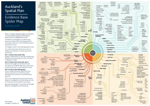
EnvironmentThis diagram is part of the evolving evidence base for the Auckland Spatial Plan, it is a graphic representation of the main, long-term data collections that Auckland Council maintains or regularly accesses. Prepared for developing the Auckland Plan.
See also: Auckland's Spatial Plan: evidence base metadata report 2010
December 2010